1. Overview
í░CFD wind power engineering softwareĘCWind Site Specification & Wind Turbine Micro-Siting
Software (WMS)í▒ is used in wind farm micro-siting, which is jointly developed by China Hydropower Engineering Consulting Group Co.úČHydropower and Water Resources Planning & Design General InstituteúČand Beijing-Millennium Engineering Software Technology Co., Ltd..
Wind farm micro-siting is determining how to locate the turbine in the place chosen by the wind macro-siting, so that the whole wind farm has a better economic benefit.
The lessons learned at home and abroad show that the loss of energy production and increased maintenance costs caused by inaccurate wind farm selection will be far more then that of a detailed investigation on the site. As a result, selection is essential to the wind farm construction. WMS considers economic and security aspects, provides the best solutions of micro-siting for maximize economic benefits.
2. Characteristics
There have been a number of wind farm micro-siting softwares abroad, which are able to automatically optimize the turbine location, determine the wake effects and the minimum space between of wind turbines, analyze and forecast wind noise, and so on. But these softwares only consider the economic aspects. WMS considers economic and security at the same time, provides better solutions for the wind farm micro-siting. The software offers two wind resource data interface, one is using the three-dimensional wind diagnostic model to calculate the wind resource data, and the other is importing wind resource data of WAsP software.
íˇConvenient to import the WAsP wind resource data
íˇAble to calculate hour by hour wind resource data
íˇPowerful mapping function, including cut, edit, compute, partition, type conversion
íˇFlexible and diverse objects setting function, including wind farm, turbine, anemometry mast, weather station, view point, noise and radar.
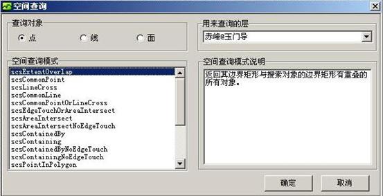
íˇVarious inquiry functions, including space query, map and property searching by each other, and mouse query.
íˇFast and efficient turbine optimization function.
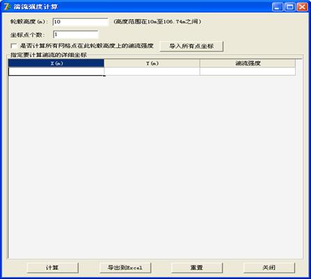
íˇSecurity computing functions, including turbulence and maximum wind speed of fifty year return period.
íˇComplete report function, including turbine report, view point report, noise report and so on.
íˇRich graphics function, visual image to show results
3. Functions
Menu design follows the habit of wind farm design as far as possible, making the entire calculation process fast and smooth. The main function of the software is as follows:

(1) Settings
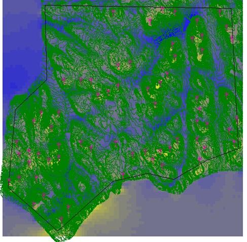
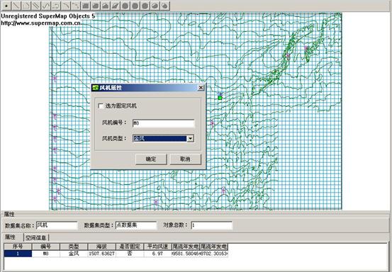
Able to set the wind farm border, and then lay the turbine, anemometry mast, view point, radar and noise in the wind farm, and can also edit the associated attributes.
(2) Inquiry
Include space inquiry, map and property searching by each other, and mouse inquiry.
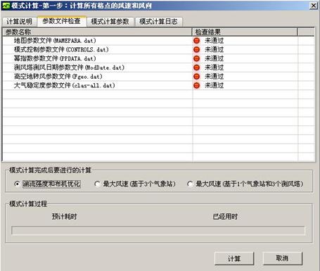
(3) Wind resource calculation
There are two ways. One is importing WASP wind resource data file in format úóWrgúó. The other is importing WEPAS wind resource data file in format úóWrgúó.
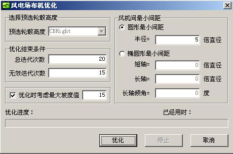
(4) Optimization calculation
Under the condition of meeting the borders settings, turbine distance, slope restrictions, WMS calculates largest energy and displays the optimization curve that energy increases as the location of turbine changes.
(5) Security computing
WMS calculates turbulence basing on the turbulent speed and calculates the maximum wind speed of fifty year return period based on the weather station data.
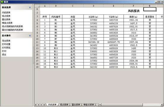
(6) Reports
After finishing the turbine optimization, calculation of turbulence and maximum wind speed of 50 year return period, WMS will automatically generates a report, including the turbine location, view point, noise and other data.
íˇTurbine report: turbine ID, X coordinates, Y coordinates, elevation, type, whether fixed, annual energy, turbulence, a case of 50-year maximum wind speed.
íˇNoise report: noise ID, X coordinates, Y coordinates, elevation, noise magnitude.
íˇ Radar report: radar ID, X coordinates, Y coordinates, elevation, height, blind angle.
íˇReport of target that the radar scans: Radar ID, target ID, target coordinates X, target coordinates Y, target elevation.
íˇView point report: Viewpoint ID, X coordinates, Y coordinates, elevation, height.
íˇReport of target that the view observes: Viewpoint ID, target ID, target coordinates X, target coordinates Y, target elevation.
íˇReport of turbulence and 50-year maximum wind speed at the limited grid: X coordinates, Y coordinates, elevation, turbulence, a case of 50-year maximum wind speed.
(7) Mapping
According to the usersí» choice, display the relevant element of the wind farm layout, including border, turbine location, noise, radar, wind speed distribution, wind power density.